Beautiful places in sri lanka

Saturday, May 30, 2020

Woulupane Hirigal Cave Ratnapura


Woulupane Hirigal Cave Ratnapura

Explore the kingdom of bats that rule in the dark, where the sun does not shine.
What do you think when you see the name Vaulpane Hirigal Cave? Yes, Kaluru Kalamaraya is a dark cave, home to more than one million bats. In fact, it is a paradise of bats. The name Voulpane is also a paradise of bats from ancient times. A few years ago, I came to know about the bats through a friend of mine who lives in the area. But on the invitation to his birthday, I was finally able to witness the unique, unique and rare creation of Nature's World. Hirigal Cave is located in the village of Wawulpane in a beautiful environment within the Kamburugamuwa Grama Seva Division of the Kolonna Divisional Secretariat of the Ratnapura District. We went to Pallebedda on the Colombo Embilipitiya bus and walked another 10 kms in a van on the Pallebedda Buluthota road.

The cave looks like a mystery. The first sight of the cave, when we were crossing the stream, was the unmistakable sound of hundreds of bats. The cave was visible from the cave. Also, carry an umbrella or a raincoat to protect the bats from falling like a light rain. There are hundreds of millions of bats above their heads as they enter the cave entrance of this rare world. After a very difficult journey through the boulders, the bats, the bats, the slippery rocks, another spectacular creation of the unbelievable nature man. It is one of the few underground waterfalls in the world. Kiwu Falls is the tallest and underground tallest waterfall in Sri Lanka. This falls is about 30 feet in height and is known as the Wawulpane Falls.We are now in the middle of a 300-meter-long cave. The cave itself is in the dark, except for a flash of light and a small beam of light that flows through a small hole on one side of the cave. Bats fly close to our bodies All of this reminds me of scenes from some horror films, and I don't have enough words to describe the experience.


Considered to be inhabited by more than one million bats, the cave is home to more than 1,000 species of bats, seven of which are endemic to Sri Lanka. We must guard against poisonous snakes in the cave. According to locals, the water inside the cave has never been exposed to sunlight and it is believed that the fish will live in it.In the cave, we could see the limestone lights of the cave in the shape of a cave. The other group, including myself, came out of the cave after a fairly difficult journey through the entrance. Leaving the cave, we reached the entrance of the cave through a jungle, and upon entering the cave, we could see the limestone and jaggery of the limestone cave (the pebbles that hang down from the top of the cave). it was. Investigations carried out by two French and Sri Lankan Geological Survey teams in 1960 confirmed that the cave is about 500 million years old. Upon returning, we could see the source of the fountain and the entrance to the cave. We have successfully completed our journey by jumping into your giant's. So for those of you who like to travel, you can go for a horror-filled 😊. Therefore, it is your responsibility to protect the beauty of the environment and the future generation while enjoying the beauty of the environment.


Share:

Thursday, May 28, 2020

Hunugal pokuna

Hunugal Pokuna

Hunugal Pokuna is a limestone pond which is situated in Kalthota. It is a naturally beautiful pond with glistening water. This unique natural pond on limestone layer. It is a popular tourist spot in the area is surrounded by many types of precious trees.


Getting to Hunugal Pokuna
From Belihuloya travel along the Colombo – Batticaloa Highway and then along the Kalthota Road passing Balangoda and Kahatapitiya up to Kalthota to reach the Hunugal Pokuna in Kalthota.


but this place is prohibited to people


Share:

Belihuloya

 Belihuloya

The waterfall gushed in mists of white spray as it tumbled off rugged rocks and dropped like an immaculate veil to flow gracefully into the surrounding jungles. Belihuloya, a charming hillside village situated in the Ratnapura District, approximately 160 kilometres from Colombo is nature’s marvel, a miracle of creation blessed with an abundance of waterfalls, streams, nature, cycling trails and numerous opportunities for bird watching and camping.

The Belihuloya River flashes a wonderful spectacle, beginning from Horton Plains, it flows and tumbles downwards into the Samanalawewa Reservoir. An area that has an expansive bio- diversity, Belihuloya embraces that gifted characteristic of semi-evergreen forests, tropical savannah forests, dry montane grasslands and montane temperate forests. Clean and serene, it is swaddled in the drapes of numerous waterfalls, surrounded and wrapped by mountain ranges and peaks from where many waters flow. The tallest waterfall in Sri Lanka, the Bambarakanda Falls, flows from here at a height of 263 metres – the 299th highest waterfall in the world. Standing at 220 meters tall, the Diyaluma Falls with an imposing flow of water is the second highest waterfall in Sri Lanka. At 60 metres in height the Surathali Falls cascades in three segments and has been christened thus following a movie that was filmed on location.

The Pahanthuda Falls is shaped like an oil lamp; Brampton Falls is set amidst lush tropical jungle and flows to the Walawe River. Be cautious at the Galagama Falls, which is known to be covered with large slippery rocks. Belihuloya is definitely for the plucky traveller, with plenty of places to explore like the Haggala Trail, which is about 2.5 hours away from Belihuloya; and the Appalagala Trail is a 2.5 hour walk through forest and grassland with great opportunities for bird watching. The Samanalawewa Trail is a half day adventure leading to the Samanalawewa Reservoir.

For the history buff, the Kuragala rock cave, dating back to the 2nd century will be a fascinating walk along antiquity. An archaeological reserve, excavations had unearthed two pre-historic skeletons of males and other artefacts. The site is revered by Buddhists and Muslims, with the presence of a temple and a mosque.

Apart from providing an unforgettable experience Belihuloya will soothe the mind and body in its tranquil surroundings.
Share:

Wednesday, May 27, 2020

Duwili Ella falls Balangoda

It is worth noting that the Duwili Ella or Dooli Ella Falls.  It  is one of the most beautiful waterfall in Sri Lanka.  Duwili Ella Falls, Thanjantenna, in Kaltotte, close to Balangoda town in the Ratnapura district.  Duwili Ella Falls can  reach by traveling about 4 kilometers from Balangoda town.

Even though there was a need to travel on a difficult road, due to the recent development of the road.It is a situation has arise  in the vicinity of the waterfall. Due to the presence of another dust in the forest area in the Sinharga forest, which is bored by the Sinharaja forest, most of them are Balangoda Desert Falls called the Kaltota Duwili Ella falls.


At a height of 130 feet above sea level, it is also higher than the height of the forest.

Kalthota Duwili Ella Falls was recently reward largely by tourists. With the roll-out of programs on dusty falls through most of the local travel television shows, the number of tourists visiting the Duwili Ella Falls has gradually increased. Kaltota Duwili Ella has become a welcome destination for foreign tourists today.

You will be able to see the Duwili Ella which comes to Balangoda area, Horton Plains National Park and Haputale. Kaltota Dewi Falls, located in a very mild and temperate climatic condition. Receives water from the water sources of the Walawe river.


At the foot of the Duwili Ella Falls, the pool is very large. As there is plenty of water to shower.  However, it is important for tourists to keep an eye on it.  Because it is not advisable to take baths during wet weather. In ancient documents, the East waterfalls of Walawe river also called as “Kaltota Duwili ella”.
Share:

Budugala Rajamaha Viharaya


The road was ever winding as we kept descending steadily from Balangoda towards Kalthota some 30 kilometers or a little more. The scenery was refreshing with long stretches devoid of the contraptions of man.


The road etched as it were on the edge of the mountain afforded a distant view of the plains below meltinginto misty greens. It was good driving

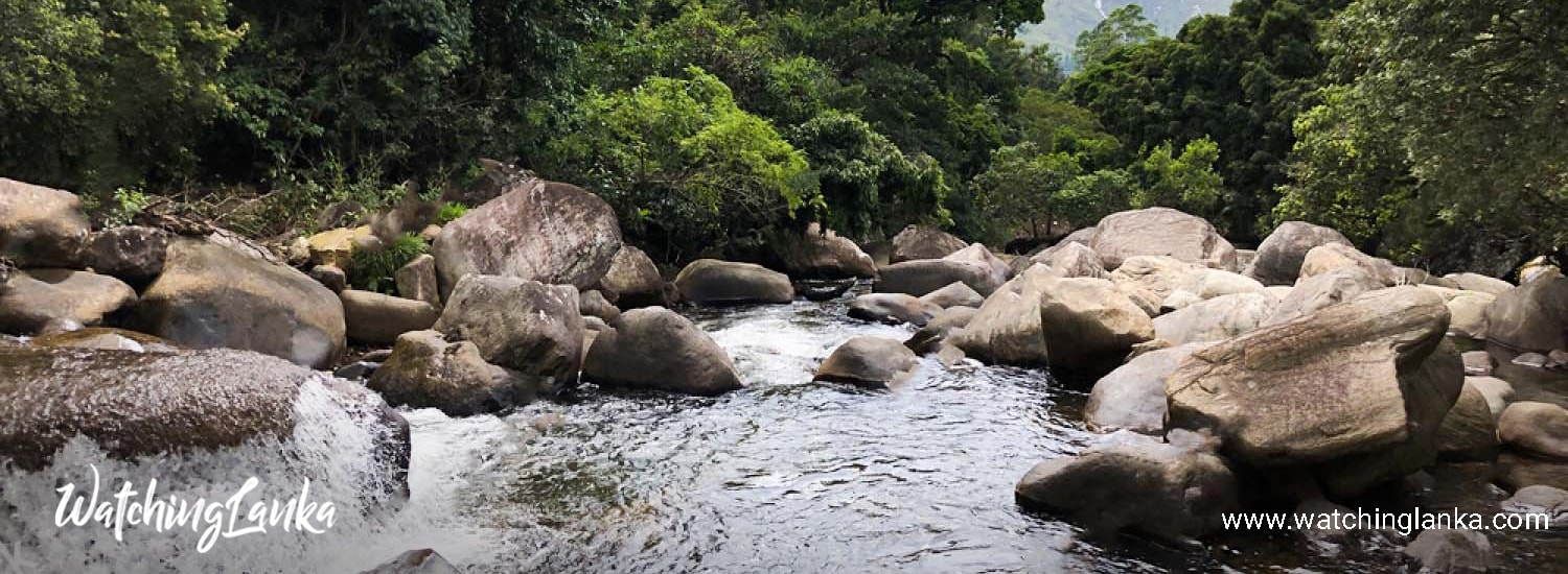
After the descent we seemed to be traveling on flat terrain. And now we were accompanied by a gushing canal of the Walawe waters, which ran closely parallel with the road. Here and there we met with old world edandas spanning the canal to give access to the properties on the opposite bank. It seemed as if the canal and the road were inseparable and we had quite got used to the idea too, when we lost sight of it momentarily, only to find it raised into a bridge like contraption making way for a branch road to travel under it. A peculiar sight.! And the canal joined the road again making a merry waterfall down some cemented steps back to its happy partnership with the road. These waters seemed to be the source of the people living here. We passed ideal bathing spots and shallow washing spots where the locals relaxed after attending to their daily chores, the surrounding trees giving excellent shade.

Our destination was the Budugala ruins in Kalthota. After a while we stopped at an Archaeological Department sign board, and parking the vehicle on the side of the narrow road hardly enough for two vehicles to pass, we crossed the canal which by now had succumbed to a narrow deep drain..

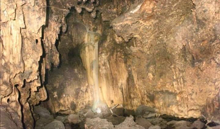
The site that met our eyes did seem interesting, but little information was available on it.


Two large rectangular foundations of buildings could be seen connecting each other at the centre by a narrow bridge. Huge polished granite slabs comprised its construction. Quaint little stone stairways with simple balustrades led to them. A few stone columns bravely seemed to stand the test of time while a medley of others littered the area around.

A steep granite stairway led uphill at first seemingly into the heavens. The steps sometimes accompanied by balustrades and embankments at different levels were built of stone in perfect geometrical harmony, with boulders littering the sides and the surrounding tree-scape creating an idyllic frame to a picturesque setting .

We climbed further on the stone steps and suddenly came upon a clearing with yet another ruin of the same design but maybe of a slightly smaller proportion..

It is believed that the Budugala ruins are those of an ancient hermitage and the constructions found here have been dated to the 1st century BC.

When we visited the ruins it was well into noon and the day was sweltering hot. But the forest of trees shaded the site. And the sun filtered through the trees freckled and dimpling at our feet. while the air rang with sweet bird calls.

To my mind came a little poem I had read earlier


Share:

Nonpareil mountain

Nonpareil Estate Waterfall is a three-step cascade located within the Nonpareil Tea estate. The exact height is unknown but could be somewhere around 20-30m. The fall is fed by unnamed stream originating from Horton plains. The stream eventually conjoins with Hirikatu Oya.

The fall is divided into two sections. There is a small base pool in the lower section wherein one can have a safe dip.

Getting There
Once you reach Belihuloya area on A4 road, turn left to Nonpareil Estate road (There are many signboards at the turning point, so it is hard to miss). [Google Street View]

This is, in fact, the road to Baker’s Bend and Nagrak Bungalow as well. Travel about 06km on this narrow road until you reach the small school building to your left. Just past this building, there is a bend and once you go past it the falls would be visible by the road.


A vehicle with high ground clearance is ideal but even a small car can survive the dilapidated road if you drive carefully.
Share:

Baker’s Bend

Baker’s Bend
Baker’s Bend is situated in upper side of the Non Pareil Estate bordering famous wildlife reserve Horton plains. The viewpoint boasts of a wonderful view of the local lowlands towards the Indian ocean, and also the Samanala Wewa Reservoir which is possible to spot on a clear day from this view point. This picturesque bend is surrounded by some beautiful mountains of the World’s End Mountain Range.

Samuel Baker – the planter, settler and the creator of Nuwara eliya (known as little England), according to legend met with an accident on his horse cart at this bend and died.


The hike to baker’s bend is only recommended for seasoned hikers.
Share:

Search This Blog

Powered by Blogger.

Translate

Woulupane Hirigal Cave Ratnapura

Woulupane Hirigal Cave Ratnapura Explore the kingdom of bats that rule in the dark, where the sun does not shine. What do you thin...

Contact Form

Name

Email *

Message *